SOME IMAGES: This Morning's Pacific Palisades Fire in Los Angeles
We think Al Gore & Bill Clinton got us within one Senate vote of starting to deal with this 32 years ago. The Republicans and seven Democratsic Senators, with Senator David Boren (D-OK) painting the bull’s-eye on his chest by taking “credit” for blocking the BTU tax, stopped us. And we are still not in gear…
Dealing with ongoing global warming over the next two generations is highly likely to be very expensive…
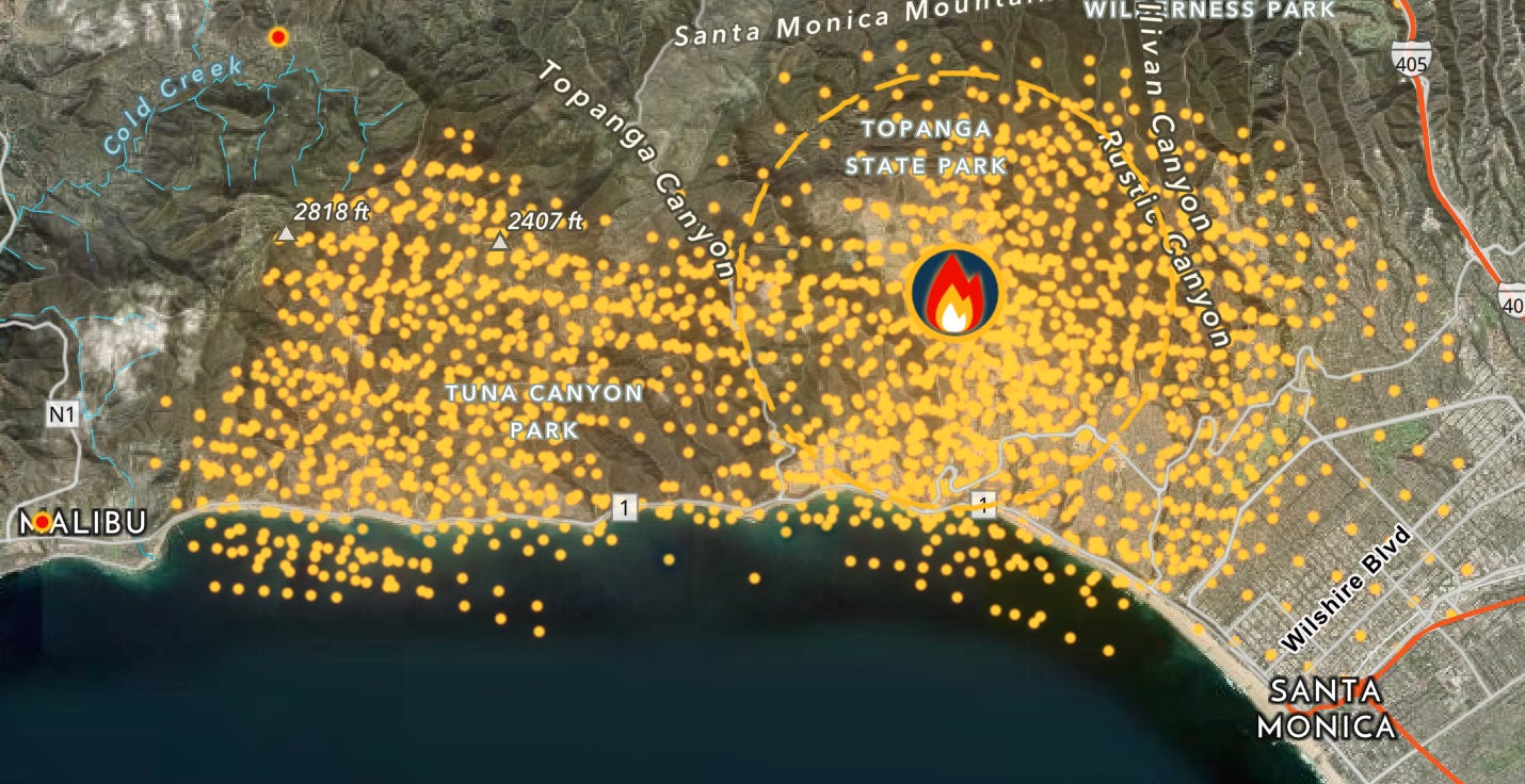
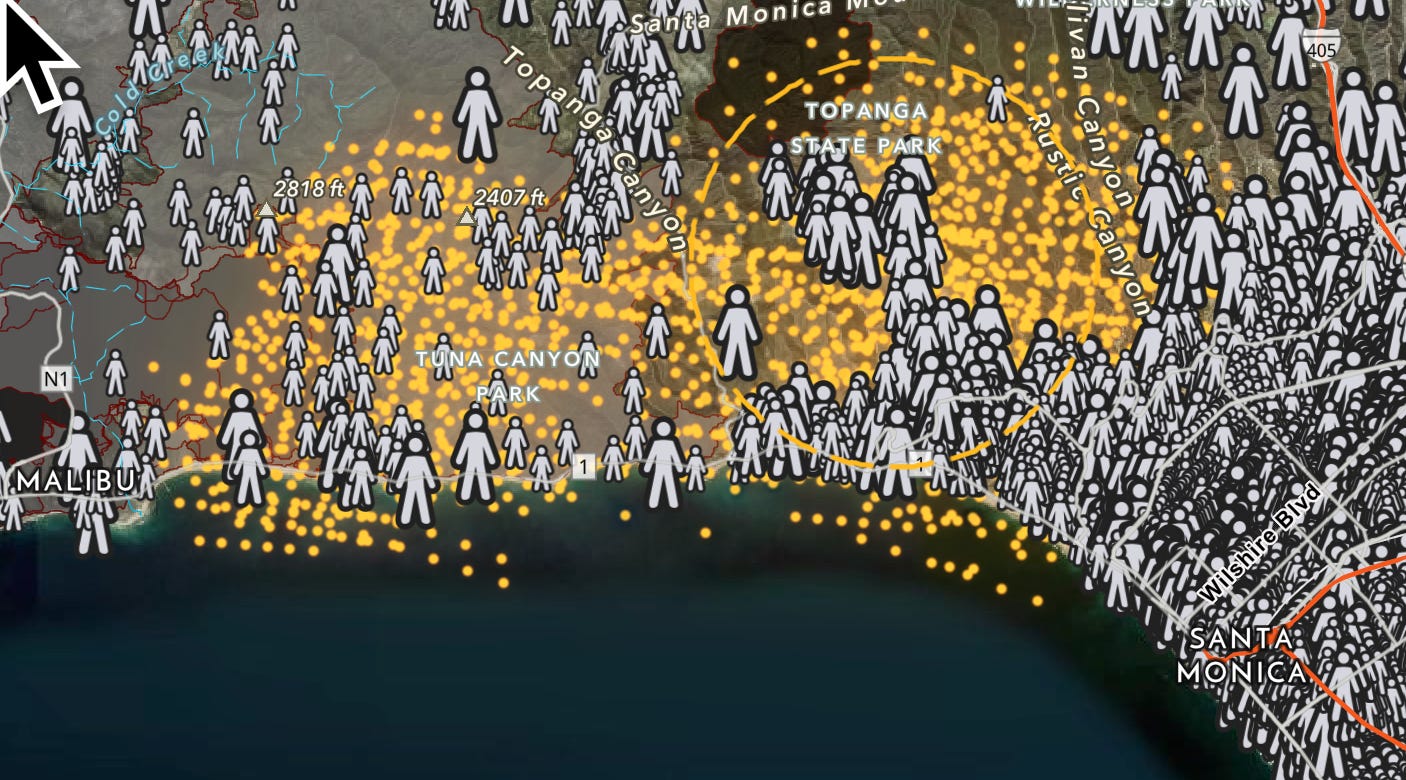
ESRI Wildfire Aware: Looking Down on the Pacific Palisades Fire, 2025-01-08 AM (We):
Malibu on the left, Santa Monica on the right. Big figures are census blocks with more than 200 residents. 30,000 people currently under evacuation orders. <https://livingatlas.arcgis.com/wildfireaware/#ext=-118.551,34.068,12,loc=a7ea5d21-f882-44b8-bf64-44ab11059dc1>.
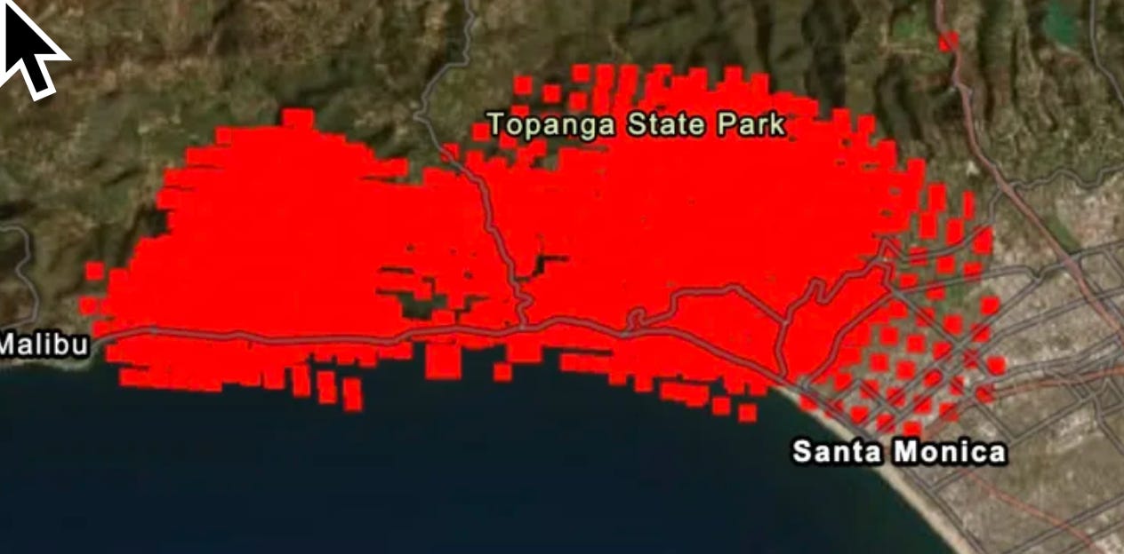
And NASA FIRMS:
<https://firms.modaps.eosdis.nasa.gov/usfs/map/#t:tsd;d:2025-01-08;@-118.53,34.06,12.17z>
KCAL News:
IQAir: “Wildfire Map Spotlight: Palisades Fire, California”: ‘What is the name and location of the wildfire?
As of 3 PM on January 7, 2025, the Palisades Fire, located in the foothills of the Pacific Palisades community of Los Angeles County, Southern California, was rapidly gaining strength and had led to an evacuation orders for the entire community (1)(2). The fire, driven by the Santa Ana winds, had quickly grown to 772 acres within a few hours.
Which cities or areas are affected by the wildfire?
The wildfire is directly affecting the following areas:
Pacific Palisades (entire community ordered to evacuate).
Parts of Malibu (areas east of Las Flores).
Santa Monica Mountains and adjacent recreational areas.
Nearby regions such as the San Fernando Valley and Topanga Canyon under evacuation warnings.
What is the current containment status of the wildfire?
As of the latest updates [i.e. 16 hours before 2025-01-08 07:00 PST (We)], the Palisades Fire has burned approximately 772 acres and is at 0% containment, with firefighters actively working to manage the blaze under challenging conditions (3).
Are there any evacuation orders or alerts in place?
There are active evacuation orders and warnings:
Evacuation Orders: The entire Pacific Palisades community and parts of Malibu (east of Las Flores). The entire Pacific Palisades community has been told to “evacuate now.”
Evacuation Warnings: Areas such as Rustic Canyon and Topanga Canyon.
Evacuation Center: Westwood Recreation Center (1350 South Sepulveda Blvd, Los Angeles, CA 90025).
Residents are urged to comply with orders and use Palisades Drive and Sunset Boulevard to evacuate south toward the Pacific Coast Highway… <https://www.iqair.com/us/newsroom/wildfire-map-spotlight-palisades-fire-california>
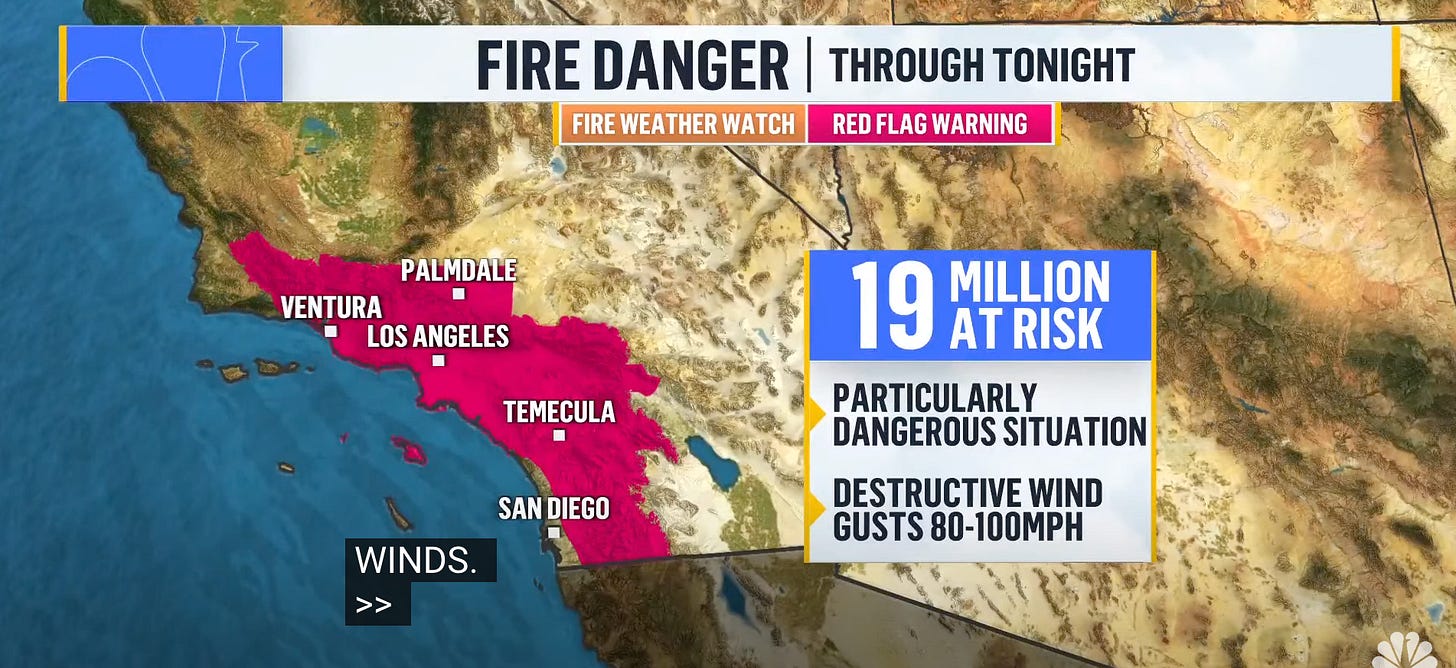
There could, during today’s Santa Ana winds, be a destructive wildfire anywhere in this red-flag zone:
Global warming driven California wildfires are expensive and produce horrifying visuals, but California is rich, and the Santa Ana winds that make wildfires effectively uncontrollable once started blow for only one day in four during the four winter months—thirty or so at-risk days a year.
The real megadangers from global warming over the next two generations come, I think, from its effects on the water systems of south, southeast, and East Asia…
If reading this gets you Value Above Replacement, then become a free subscriber to this newsletter. And forward it! And if your VAR from this newsletter is in the three digits or more each year, please become a paid subscriber! I am trying to make you readers—and myself—smarter. Please tell me if I succeed, or how I fail…


